From watersheds to Koala habitats - tackling ecosystem restoration with data
Camellia Williams
Communications Manager, Restor
Grazia Frontoso
Head of Customer Engineering Sovereignty Specialists, EMEA North, Google Cloud
Protecting the earth’s ecosystems from further degradation and improving outcomes for the wildlife and communities that rely on them needs to be a focus for the next decade of climate action. Ecosystem restoration is proving to be a powerful solution to slow and prevent the worst impacts of climate change, prevent 60% of predicted species extinctions1, and improve food security for more than 1.3 billion people2. But restoration can be hard to do successfully for many reasons.
Every ecosystem is different and therefore requires a unique approach. This means deciding when a site should be left to regenerate naturally, and when and what species to plant if a more active intervention is required. Furthermore, the process must involve the local community, because, without their support, projects are likely to fail. Finally, it requires funding to not only start projects but to maintain and care for them. Restoration takes time and it can take decades for the positive impacts to be felt.
To solve this knowledge gap, and accelerate restoration, we need to connect local projects to each other and to the scientific data, funding, learning opportunities, and experts that increase the impact, scale, and sustainability of restoration efforts. Enter Restor, an open data platform to connect everyone involved in the global restoration movement.
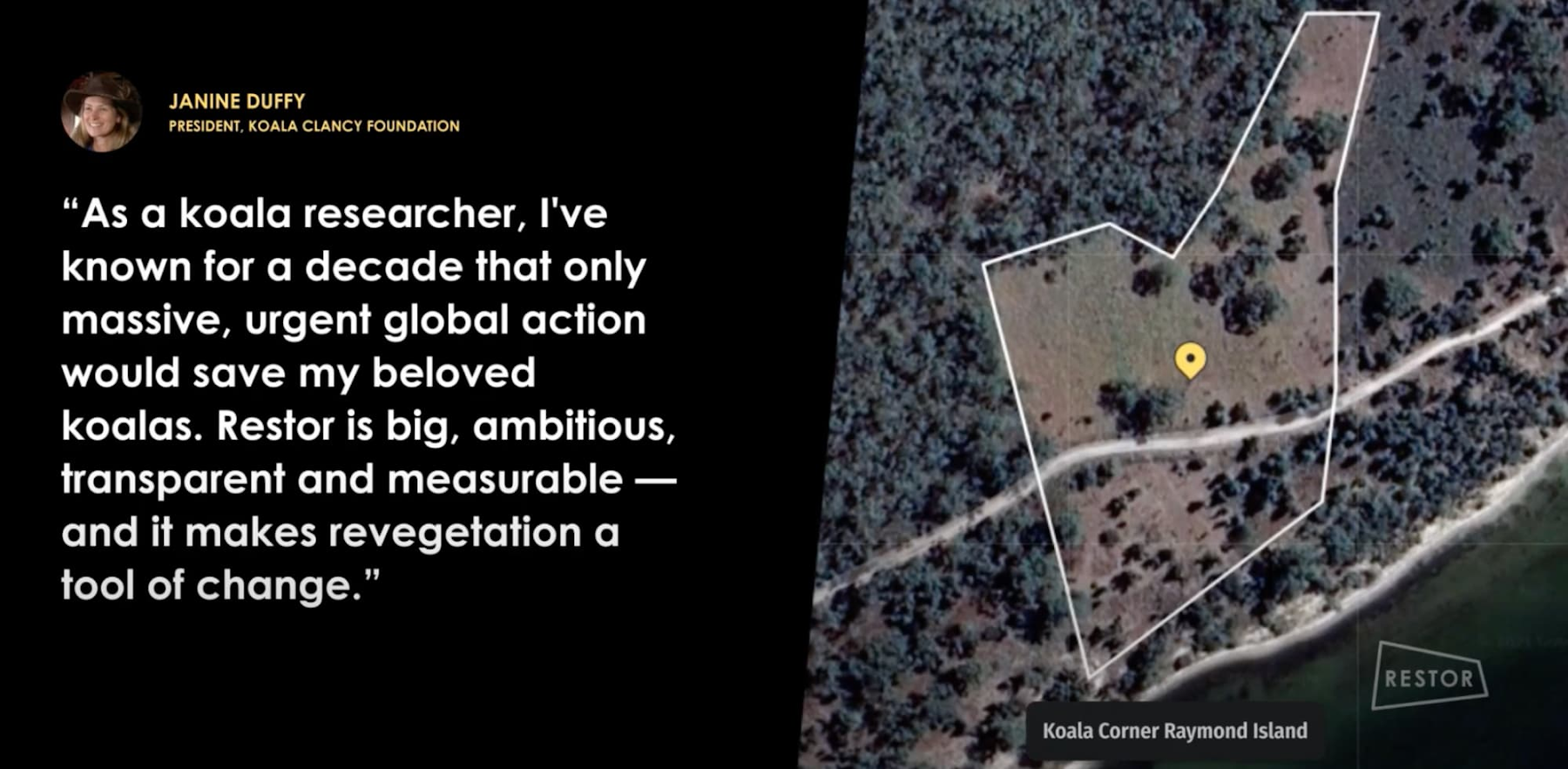
Restor believes anyone can be a restoration champion, and their platform provides the knowledge and guidance people need to manage and monitor restoration projects. People like Janine Duffy, Founder and President of the Koala Clancy Foundation, who felt renewed hope for the future of Australia’s koalas when she heard that Restor is here to support her and her restoration work.
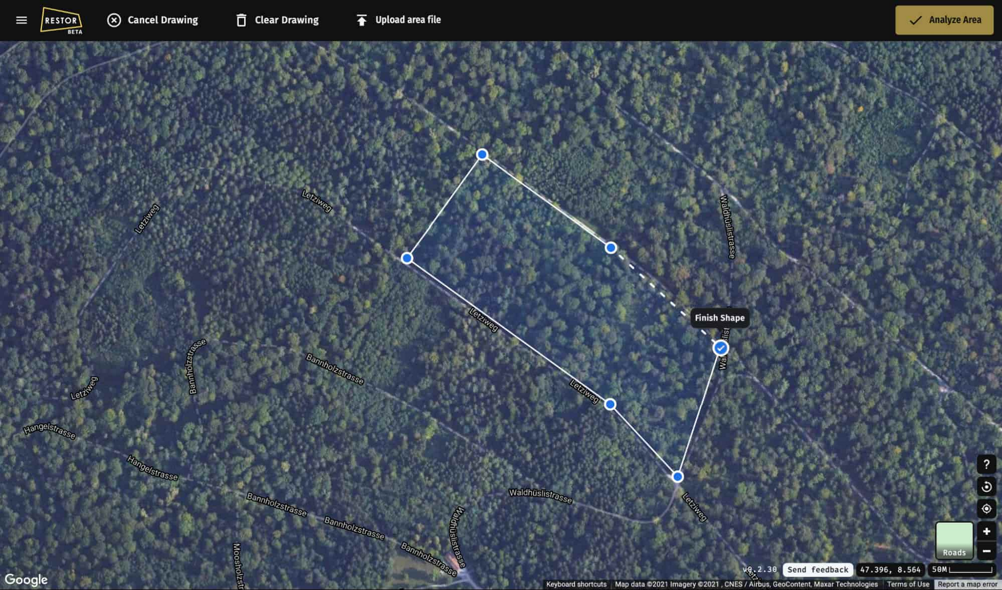
Analyzing years of earth’s surface changes instantaneously
The kind of instantaneous analyses available on Restor was not possible before Google Earth Engine existed. Today anyone with access to a computer or smartphone can access the petabytes of observation data in Earth Engine and view global statistics on tree cover loss, habitat change, or species distribution in just a few clicks. But 10-15 years ago, national-level mapping and analysis was the largest scale anyone worked at. It would take scientists like Andrew Cottam, Restor’s Head of Geospatial, weeks to download and analyze datasets and satellite imagery. He would receive hard drives in the mail and upload the data onto his computers. But now that everything is in the cloud, he can do the same analysis in a fraction of the time, and share it with the global communities and organizations using Restor.
The data in Earth Engine helps scientists, researchers, and developers detect changes, map trends, and quantify differences on the Earth’s surface. Restor uses this to provide locally-specific insights such as which species might be present, soil pH, vegetation change, rainfall amounts, carbon sequestration potential, and much more so restoration projects can have a positive and lasting impact.
A restoration practitioner can use these insights to understand which native species would thrive in particular environmental conditions, or show potential funders how much carbon can be sequestered if a site is restored. The satellite imagery opens up opportunities for low-cost, long-term monitoring of changes over time.
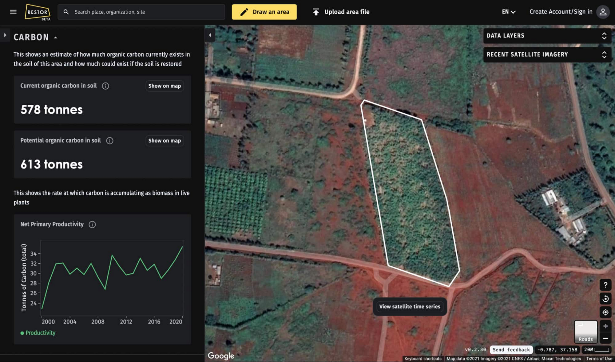
To provide these insights quickly, Restor benefits from the ability to cache around 3 million pre-calculated insights in the Google Cloud Platform. This means that when someone draws a polygon and clicks analyze on the Restor platform, they receive 23 different insights in mere seconds from a multi-petabyte catalog of satellite imagery and geospatial datasets. This improves the performance of the platform and the user experience, and creates space for Restor to grow and scale as new data becomes available.
Google Cloud Platform allows the Restor team to explore several technologies (including Google Earth Engine) within one architecture using a common set of tools with easy integration. We are a small team, and for our work to be efficient, interoperability and automation play a key role. Google Cloud Platform has been instrumental to achieving more with fewer resources.
Andrew Cottam, Restor’s Head of Geospatial.
A growing, global movement
Founded by ETH Zurich’s Crowther Lab and developed in collaboration with Google, Restor is an Earthshot Prize 2021 Finalist and an official partner of the UN Decade on Ecosystem Restoration. More than 520 organizations in 110 countries have joined Restor since its beta launch in June 2021. Restor is now home to 76,700 restoration sites and counting, shining a bright light on the local efforts happening worldwide to restore and conserve nature.
A platform with the depth of insights offered by Restor is made possible with the power of cloud computing. Google Earth Engine is a key tool in the fight against climate change and our ability to understand the fastest, most effective way to restore the planet’s ecosystems.
1. https://www.nature.com/articles/s41586-020-2784-9
2. https://www.ipcc.ch/site/assets/uploads/sites/4/2019/11/09_Chapter-6.pdf